The trail map
The trail passes through: Prato allo Stelvio - Trafoi - Passo dello Stelvio
Map and altitude:Full screen map
Scroll the altimetry to see the point on the map.


Trail details
| Distance | |
| Total distance: | 24,86 km |
| Distance of Climbing: | 21,07 km |
| Distance of Descent: | 0,58 km |
| Distance of Flat: | 3,22 km |
| Elevation Change | |
| Min elevation: | 921 m |
| Max elevation: | 2751 m |
| Total ascent: | 1857 m |
| Total descent: | 27 m |
Scan the QR code with your smartphone and bring the data of this trail with you.

Trail description
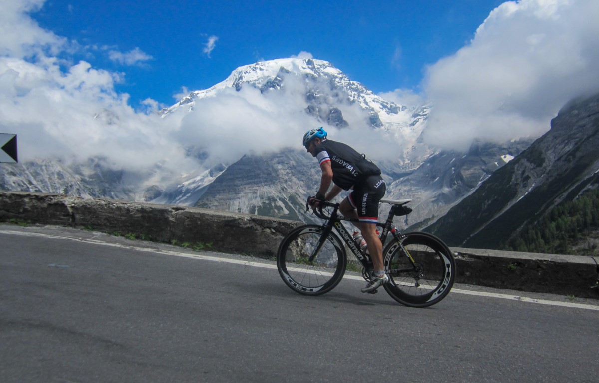
The ascent to the Stelvio Pass from Prato by bicycle has the flavor of the legendary exploits of the Giro d'Italia.
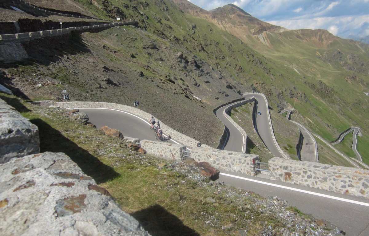
It represents the most difficult to reach the pass, given that you have to face 48 hairpin bends and almost 25 km of effort and excitement.
The first section is generally very difficult due to the high temperatures that can be found in summer. Gomagoi is a small village on the route and you always face it at very high temperatures.
After a while you reach Trafoi without too many difficulties.
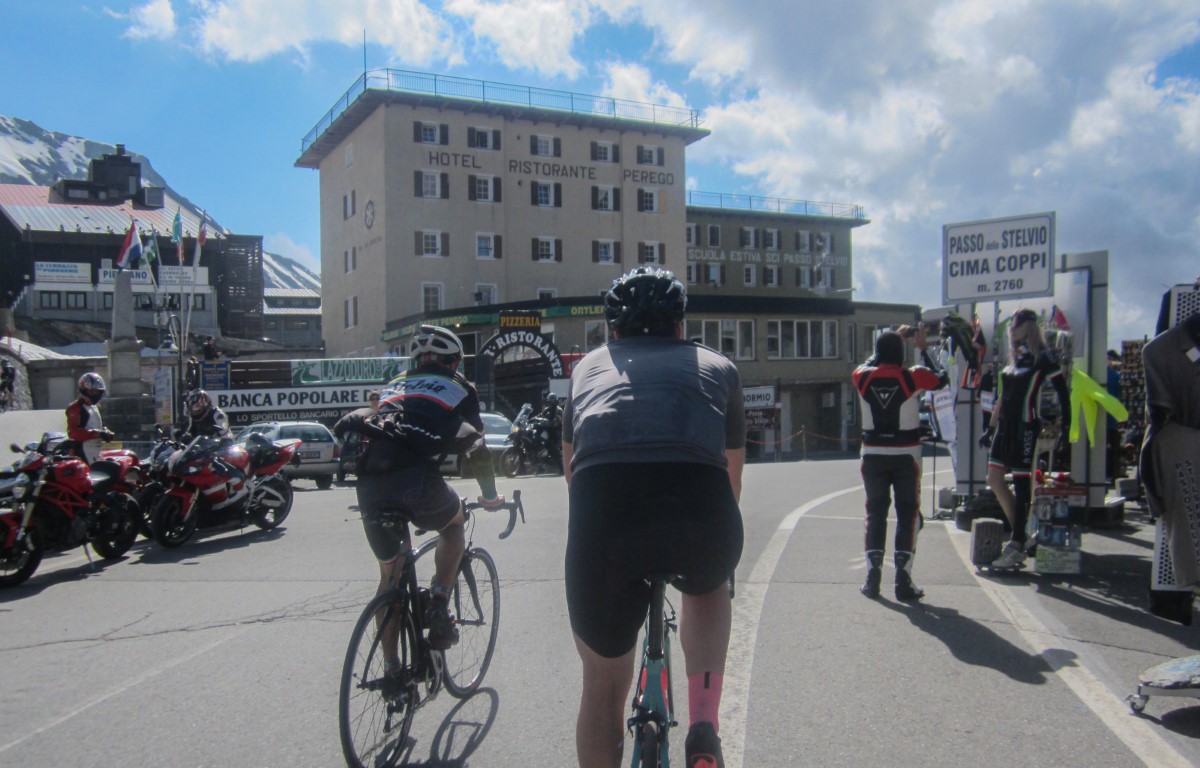
< p>The real ascent to the Stelvio starts from there, where the hairpin bends begin to follow one another without stopping, accompanied by a gentle giant: Mount Ortles. The highest mountain in the area, which stands out and seems to follow the cyclists in their toils.Unfortunately, this climb does not give up until the end and you have to sweat to reach the top, which represents joy and satisfaction for everyone .
This trail has been viewed 15233 times.